
REALPIPE · AI Sewer Intelligence
From Pipe to Proof. One Intelligence System.
REALPIPE turns sewer CCTV into measurable, traceable infrastructure evidence — cutting 60 minutes of manual first-pass review down to 5.
- Available now
- Sign up and analyze 10 videos for free
Platform Scale
Proven at municipal scale.
137,642
Validated defect records
56,926
Manholes under management
16,638
Inspection videos processed
540km
Sewer CCTV processed
90%
Expert agreement on AI re-check
44
Municipal projects
The Problem
The bottleneck isn't capture. It's human review.
Contractors watch CCTV footage, identify defects, and prepare records; municipal officials then re-check that footage to judge reliability. Conventional review alone demands roughly 22.5 minutes of oversight per kilometer — before first-pass interpretation is even counted.
22.5 min/km
of active municipal review under conventional oversight
- 01
Capacity capped by viewing time
Inspection capacity is limited by how many hours humans can spend watching footage — not by how much video can be captured.
- 02
Class labels, not measurements
Conventional AI returns a defect classification. It does not return a measurable damaged area with shape, extent and length.
- 03
Evidence is fragmented
Findings are scattered across video, reports, maps and records — so officials spend expert time searching rather than judging.
Pixel-Level AI
Defects, Segmented Pixel by Pixel.
90+% expert agreement with multi-class instance segmentation
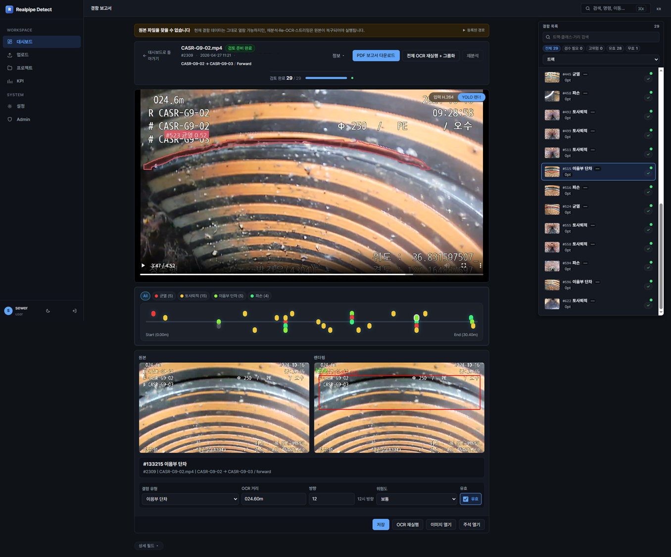
Rather than only identifying that a defect exists within a region of an image, REALPIPE separates the actual defect area at the pixel level. Defects are represented not only by a class label, but by measurable characteristics.
Instead of reporting only that a crack is present, REALPIPE returns the measured region that crack occupies — the richer unit of information municipal reviewers need for infrastructure decisions.
- Shape
- Area
- Length
- Spatial extent
- Geometry
Source-Linked Evidence
Every Finding Has a Source.
An AI prediction is not REALPIPE's final output. Each finding is bound to its CCTV source, inspection distance, pipe location, metadata and related asset history inside a Node–Link–Issue Web-GIS.
AI confidence scores and defect labels never replace the source material — a reviewer can always move from the interpreted result back to the original evidence.
The evidence chain behind every finding
- 01 Source CCTV frame & video
- 02 Inspection distance & timestamp
- 03 Orientation & clock position
- 04 Pipe segment & asset metadata
- 05 Complaints & repair history
- 06 Final human approval
Integrity by design
Capture-time SHA-256 records · TLS 1.3 transfer · store-and-forward recovery · independent server re-verification. Missing or inconsistent evidence surfaces as an exception.
AI-Prepared Review
12× Faster First-Pass Interpretation & Reporting.
BEFORE — Manual review. Hours of work.
60 min
AFTER — AI-assisted. Minutes to complete.
5 min
A workflow that can require roughly 60 minutes of manual interpretation and reporting is reduced to about 5 minutes under current benchmarks — with standardized output. Human effort moves to judgment, where it matters most.
Oversight, not endless viewing
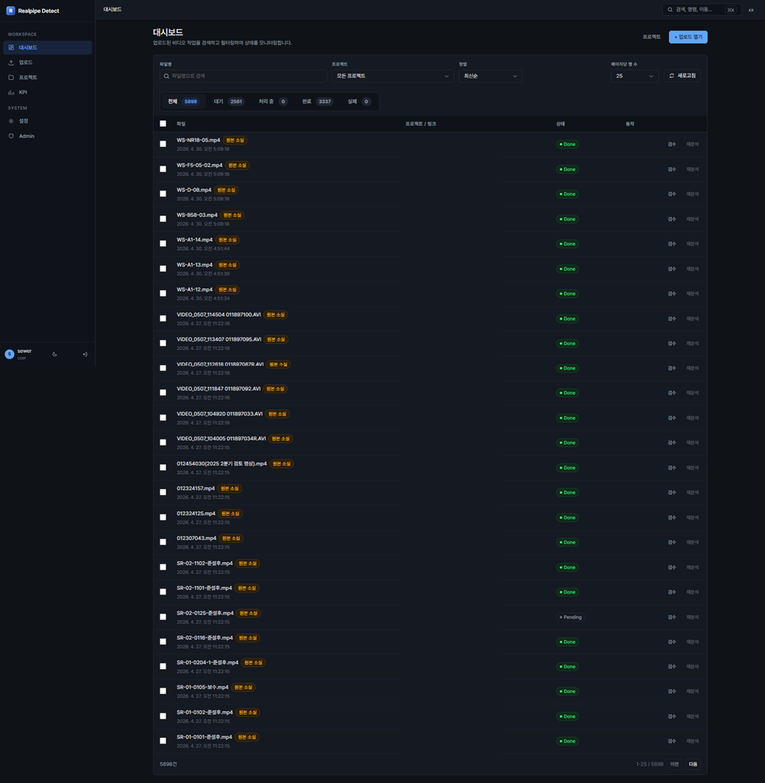
In five preliminary samples covering 3.9 km, 114 CCTV segments and 383 AI findings, measured active municipal review time fell from 22.5 to 6.98 min/km. Reviewers concentrate on significant findings and evidence exceptions — without losing visibility.
3.2×
Oversight efficiency gain
−69%
Active review time
6.98
min/km measured review
Capabilities
Five capabilities. One evidence-centered workflow.
REALPIPE connects five capabilities that reduce human work while preserving human review.
01
Pixel-Level AI Interpretation
Multi-class instance segmentation identifies individual defect regions at pixel level — representing defect geometry and measurement, not just a detection or class.
02
Automated First-Pass Interpretation & Reporting
Roughly 60 minutes of manual interpretation and reporting reduced to about 5 minutes, with standardized output — automating the repetitive review stage after CCTV capture.
03
Evidence-Linked Review
Each result stays connected to its source CCTV evidence, inspection distance, location, orientation and metadata. Officials can inspect the evidence behind every AI output themselves.
04
Exception-Focused Municipal Oversight
Rather than watching every submitted video in full, reviewers concentrate on significant findings and evidence exceptions — a measured 3.2× oversight efficiency gain.
05
Longitudinal Infrastructure Intelligence
1,285 pipe segments already matched across multiple inspection years — the same infrastructure compared over time instead of isolated survey documents.
Why It's Different
Not just detection. A pixel-level evidence layer for municipal decisions.
Conventional AI asks "what defect is in this frame?" REALPIPE identifies what a defect is, how much infrastructure it occupies, where the evidence sits, and what a reviewer must verify.
- Detection Measurement
Segmentation preserves each defect's actual spatial extent and supports measurement of shape, area and length.
- Prediction Evidence
Every prediction is bound to source footage, distance, location, asset metadata and inspection history — a traceable evidence record.
- Manual first pass AI full-set screening
The repetitive first-pass interpretation of captured footage is automated; human effort moves to judgment.
- Complete viewing Complete oversight
Municipal users don't lose visibility — REALPIPE simply changes what humans need to view.
- Isolated surveys Infrastructure memory
The Node–Link–Issue model connects repeated inspections to the same asset, preserving a pipe's history.
Community Security
Make hidden infrastructure risk visible — before it surfaces.
In Korea, 46.6% of 957 analyzed ground-subsidence incidents were attributed to sewer damage — defects hidden underground becoming visible public-safety failures above ground.
REALPIPE currently manages more than 56,000 leakage-path-related defect records, connecting each issue to its source evidence and infrastructure location. Municipalities can examine not only whether a defect exists today, but whether conditions are recurring, changing or accumulating across inspections.
REALPIPE does not automate the public-safety decision itself. It gives the officials responsible for that decision earlier visibility, more consistent evidence and a stronger basis for judgment.
46.6%
of 957 analyzed ground-subsidence incidents attributed to sewer damage
56,000+
leakage-path-related defect records under management
1,285
pipe segments matched across multiple inspection years
Technical Specifications
Built for the field. Verified on the server.
- AI CORE
- Multi-class instance segmentation
- THROUGHPUT
- Sewer CCTV processed at up to 30 fps
- EDGE
- Hardware-flexible industrial Edge Device — Jetson Orin NX reference configuration
- ACCURACY
- mAP50 55% · 90% expert agreement on AI re-check
- INTEGRITY
- SHA-256 capture records · TLS 1.3 transfer · independent server re-verification
- WEB-GIS
- Node–Link–Issue model · one-second response
- REPORTING
- Standardized report generation in five minutes
- SCALE
- 540 km processed · 137,642 validated defect records
Get Started
See REALPIPE in action.
Experience how sewer CCTV becomes measurable evidence and accountable oversight — from pipe to proof.
- Available now
- Sign up and analyze 10 videos for free
realpipe.net